From correspondents in Moscow
May 24, 2007
NAVIGATING devices using Russian satellites will appear in the shops this year as the first alternative to the widely used GPS network of the United States, officials said overnight.
"The individual devices receiving signals from Glonass will appear in shops in our country by the end of this year," Russia's First Deputy Prime Minister Sergei Ivanov said.
The Glonass satellite network, which is also used by the Russian military, was set up to compete with the US' GPS network, which is widely used around the world, and Europe's planned Galileo system.
But development of the system has lagged behind schedule, and Mr Ivanov conceded that it would only have global coverage - with a planned total of 24 satellites - by 2009.
The Russian devices, which will also receive signals from the GPS network, can be used by planes, ships, armoured vehicles and trains, as well as by individual users, Mr Ivanov said.
Source: http://www.theaustralian.news.com.au/story/0,20867,21785808-1702,00.html
Showing posts with label glonass. Show all posts
Showing posts with label glonass. Show all posts
Thursday, May 24, 2007

Space official says Glonass to equal precision of GPS by 2011
 MOSCOW REGION, May 24 (RIA Novosti) - A senior space official said Thursday Russia's Glonass global positioning system should reach the same precision level as the U.S. Global Positioning System (GPS) by 2011.
Glonass is designed for both military and civilian use, allowing users to identify their positions in real time.
A deputy director of the Federal Space Agency, Yury Nosenko, speaking at a news conference with top designers of Glonass in the Moscow Region, said: "Our aim is to improve the precision of the Glonass system's operations for civilian users down to one meter by 2011. The American GPS system is already working at this precision level."
When the improved Glonass-K satellites with a 10-year service life are complete, the system will be as good as GPS, and users will be able to use both systems, Nosenko said.
A total of $380 million in 2007 federal budget funds was allocated for Glonass, compared to last year's $181 million. The first launch under the Glonass program took place October 12, 1982, but the system was only formally launched on September 24, 1993.
The satellites currently in use are of two modifications - Glonass and its updated version Glonass-M. The latter has a longer service life of seven years and is equipped with updated antenna feeder systems and an additional navigation frequency for civilian users.
Nikolai Testoyedov, the head of NPO Reshetnev, a state-controlled company that builds satellites for Glonass, told the news conference that six Glonass-M satellites will be put into orbit by Proton carrier rockets by the end of 2007. Another six satellites will be added to the Glonass system in 2008, and the first two improved Glonass-K satellites will be launched in 2009.
The future modification, Glonass-K, is an entirely new model based on a non-pressurized platform, standardized to the specifications of the previous models' platform, Express-1000.
Source: http://en.rian.ru/russia/20070524/66028312.html
Ukraine and Russia to cooperate in GLONASS
RBC, 24.05.2007, Kiev 09:53:46.Ukraine and Russia have discussed the prospects of cooperation in setting up ground infrastructure to make it possible for Russian and Ukrainian consumers to use GLONASS and other navigation satellite systems, Ukrainian National Space Agency General Director Yury Alekseyev told journalists today following a space industry meeting in Moscow on May 17-18.
According to Alekseyev, practical steps have been planned to start work on establishing ground infrastructure, including a trial launch of a fragment of the system on Ukraine and Russia's bordering territories, Crimea and the Krasnodar region, as early as 2008.
Source: http://www.rbcnews.com/free/20070524095346.shtml
According to Alekseyev, practical steps have been planned to start work on establishing ground infrastructure, including a trial launch of a fragment of the system on Ukraine and Russia's bordering territories, Crimea and the Krasnodar region, as early as 2008.
Source: http://www.rbcnews.com/free/20070524095346.shtml
Friday, May 18, 2007
Putin makes Glonass navigation system free for customers
 Russian President Vladimir Putin signed Friday a decree on the Glonass navigation system to provide the service free for customers, the Kremlin press service said.
Glonass is a Russian version of the U.S. Global Positioning System (GPS), which is designed for both military and civilian use, and allows users to identify their positions in real time. The system can also be used in geological prospecting.
“Access to civilian navigation signals of global navigation satellite system Glonass is provided to Russian and foreign consumers free of charge and without limitations,” the presidential decree reads.
In line with the decree, satellite navigation equipment bought for federal bodies of executive power and organizations subordinate to them should operate using Glonass signals.
Putin charged the Federal Space Agency with coordinating work to maintain, develop and use the system for civilian and commercial needs.
The head of the space agency said in April Russia will bring the number of satellites comprising its Glonass navigation system to 18 by the end of 2007.
Anatoly Perminov said then a full orbital group of 24 satellites will be ready for global coverage by the end of 2009, but even with 18 satellites in orbit it will be able to start providing services for military and civilian users, covering Russian territory.
A total of $380 million has been appropriated for Glonass from the federal budget in 2007, and $181 million in 2006.
The space agency head also said that Glonass will be fully integrated with the U.S. GPS and European Galileo satellite navigation systems.
“We will ensure the compatibility and complimentary use of the Russian Glonass system with the American GPS, and later with the European Galileo systems,” he said.
The first launch under the Glonass program took place October 12, 1982, but the system was only formally launched September 24, 1993.
The satellites currently in use are of two modifications - Glonass and its updated version Glonass-M. The latter has a longer service life of seven years and is equipped with updated antenna feeder systems and an additional navigation frequency for civilian users.
A future modification, Glonass-K, is an entirely new model based on a non-pressurized platform, standardized to the specifications of the previous models’ platform, Express-1000.
Glonass-Ks’ estimated service life has been increased to 10-12 years, and a third, “civilian” L-range frequency has been added.
Source: RIA Novosti
Tuesday, May 15, 2007
First Russian PDA For Military Purposes
 Russian research-and-production company “Technica-Service” has announced its plans for 2007 – launching production of a palm computer “Kulon” in hardened shell and with embedded GPS receiver.
First Russian portable digital assistant “for military purposes” is based upon PX270 processor with frequency of 624 MHz. The device also has a VGA-display, and palm owners will be able to choose between two operational systems: Windows CE.net 5.0 and Windows Mobile 2005.
GPS receiver is already built in the palm, and developers claim to produce PDAs with receivers for both GPS and GLONASS navigation systems.
However, developers said nothing about whether their device will have any components, produced in Russia.
Source: http://www.russia-ic.com/news/show/3968/
Ivanov urges measures to enhance competitiveness of GLONASS
SYKTYVKAR, May 15 (Itar-Tass) -- Russia’s First Deputy Prime Minister Sergei Ivanov has urged safeguarding Russia’s interests in space exploration and development, including the competitiveness of the GLONASS satellite navigation system.
“We must and we shall work seriously on our GLONASS system,” Ivanov told a student audience at a college in Syktyvkar.
“We should literally elbow our way through to safeguard our interests. We should work really hard, if we want to be competitive,” Ivanov said, adding that the GPS navigation system was already operational and its European counterpart Galileo was in the creation phase.
Source: http://www.itar-tass.com/eng/level2.html?NewsID=11529482&PageNum=0
“We must and we shall work seriously on our GLONASS system,” Ivanov told a student audience at a college in Syktyvkar.
“We should literally elbow our way through to safeguard our interests. We should work really hard, if we want to be competitive,” Ivanov said, adding that the GPS navigation system was already operational and its European counterpart Galileo was in the creation phase.
Source: http://www.itar-tass.com/eng/level2.html?NewsID=11529482&PageNum=0
Sunday, May 13, 2007
Topcon to Acquire Sokkia
Mar 24, 2007
GPS World
Topcon Corp. announced it has come to a "basic agreement" to acquire Sokkia Company Limited (Sokkia). If approved by the Japanese Fair Trade Commission (FTC), Sokkia will become a Topcon subsidiary and will be renamed Sokkia Topcon. Because both companies are headquartered in Japan, the transaction is subject to approval by the Japanese FTC with respect to anti-trust regulation. Topcon states that further details will be released after the Japanese FTC has commented on the proposed acquisition.
The announcement states the reason for the merger of the two companies is to maintain an edge in the increasingly competitive worldwide surveying instruments market. Competitors Leica Geosystems AG and Trimble Navigation Ltd. have been acquiring companies to increase market strength for some time. The announcement also gives increased competition from Chinese manufacturers as another driver for the Sokkia acquisition.
Surveying instruments (Positioning Business) is the largest business segment of Topcon Corp., as it produced approximately $400 million in revenue in fiscal year 2006 (ending March 2006). Other business segments include Opthalmic/Medical, Industrial, and Optical Devices instruments. Companywide revenues for FY2006 were approximately $913 million. According to the company, it implemented a mid-term growth strategy in FY2006 targeting annual revenue of $640 million for the Positioning Business segment.
Sokkia's sole business is surveying instruments. Its worldwide FY2006 revenues for the same period were approximately $187 million.
Both companies have formidable worldwide distribution channels. No details have been released about how the acquisition will affect the two channels, although the announcement mentions that the Sokkia brand will be maintained for an interim period.
NovAtel Role. An area of ambiguity is Sokkia's joint venture with NovAtel, Inc., of Calgary, Alberta, Canada. NovAtel designs GNSS technology that Sokkia incorporates into its GNSS surveying products through a joint venture named Point, Inc., established in 1999. Sokkia owns 51 percent of Point while NovAtel owns 49 percent.
Topcon has a solid investment in GNSS technology, which began with its acquisition of the former Javad Positioning Systems in July 2000. Since FY2004, Topcon has experienced record revenues for each year and strong growth in the GNSS receiver sector, while becoming a leader in producing receivers that use both GPS and Russian GLONASS satellite signals.
Following the Topcon announcement, NovAtel CEO Jon Ladd responded that "NovAtel and Sokkia have existing contracts in place under which NovAtel develops and supplies GPS technology and products to our joint venture Point and ultimately to Sokkia. We do not expect the proposed combination of Topcon with Sokkia to affect our business relationship with Sokkia, for the foreseeable future. We continue to work with Sokkia management to develop new GNSS technology that will be incorporated into the Point/Sokkia product family." According to NovAtel, the Point agreement is effective until July 2009.
Furthermore, Hitoshi Ito, president of Sokkia Co., Ltd., stated, "We value our relationship with NovAtel and do not expect there will be a material change to our relationship."
According to NovAtel, the Point venture accounted for approximately $9 million of NovAtel's $67 million total annual revenue in FY2006.
Source: http://sc.gpsworld.com/gpssc/article/articleDetail.jsp;jsessionid=GHjkDVyTgvQmYPPVybyGxR7mGhCYWG3pJYfz1mSnhrTKbXKnj6Rv!284891640?id=414512
GPS World
Topcon Corp. announced it has come to a "basic agreement" to acquire Sokkia Company Limited (Sokkia). If approved by the Japanese Fair Trade Commission (FTC), Sokkia will become a Topcon subsidiary and will be renamed Sokkia Topcon. Because both companies are headquartered in Japan, the transaction is subject to approval by the Japanese FTC with respect to anti-trust regulation. Topcon states that further details will be released after the Japanese FTC has commented on the proposed acquisition.
The announcement states the reason for the merger of the two companies is to maintain an edge in the increasingly competitive worldwide surveying instruments market. Competitors Leica Geosystems AG and Trimble Navigation Ltd. have been acquiring companies to increase market strength for some time. The announcement also gives increased competition from Chinese manufacturers as another driver for the Sokkia acquisition.
Surveying instruments (Positioning Business) is the largest business segment of Topcon Corp., as it produced approximately $400 million in revenue in fiscal year 2006 (ending March 2006). Other business segments include Opthalmic/Medical, Industrial, and Optical Devices instruments. Companywide revenues for FY2006 were approximately $913 million. According to the company, it implemented a mid-term growth strategy in FY2006 targeting annual revenue of $640 million for the Positioning Business segment.
Sokkia's sole business is surveying instruments. Its worldwide FY2006 revenues for the same period were approximately $187 million.
Both companies have formidable worldwide distribution channels. No details have been released about how the acquisition will affect the two channels, although the announcement mentions that the Sokkia brand will be maintained for an interim period.
NovAtel Role. An area of ambiguity is Sokkia's joint venture with NovAtel, Inc., of Calgary, Alberta, Canada. NovAtel designs GNSS technology that Sokkia incorporates into its GNSS surveying products through a joint venture named Point, Inc., established in 1999. Sokkia owns 51 percent of Point while NovAtel owns 49 percent.
Topcon has a solid investment in GNSS technology, which began with its acquisition of the former Javad Positioning Systems in July 2000. Since FY2004, Topcon has experienced record revenues for each year and strong growth in the GNSS receiver sector, while becoming a leader in producing receivers that use both GPS and Russian GLONASS satellite signals.
Following the Topcon announcement, NovAtel CEO Jon Ladd responded that "NovAtel and Sokkia have existing contracts in place under which NovAtel develops and supplies GPS technology and products to our joint venture Point and ultimately to Sokkia. We do not expect the proposed combination of Topcon with Sokkia to affect our business relationship with Sokkia, for the foreseeable future. We continue to work with Sokkia management to develop new GNSS technology that will be incorporated into the Point/Sokkia product family." According to NovAtel, the Point agreement is effective until July 2009.
Furthermore, Hitoshi Ito, president of Sokkia Co., Ltd., stated, "We value our relationship with NovAtel and do not expect there will be a material change to our relationship."
According to NovAtel, the Point venture accounted for approximately $9 million of NovAtel's $67 million total annual revenue in FY2006.
Source: http://sc.gpsworld.com/gpssc/article/articleDetail.jsp;jsessionid=GHjkDVyTgvQmYPPVybyGxR7mGhCYWG3pJYfz1mSnhrTKbXKnj6Rv!284891640?id=414512
Saturday, May 12, 2007
Russia in talks with other countries on joint Glonass use
MOSCOW, December 5 (RIA Novosti) - Russia is negotiating with other countries on the possible joint use of Russia's global positioning satellite system Glonass, the head of the Russian Space Agency said Tuesday.
Glonass, a Russian version of the U.S. Global Positioning System (GPS), is designed for both military and civilian purposes, and allows users to identify their positions in real time. It can also be used in geological prospecting.
"We are in active talks with India, Kazakhstan, Ukraine and other countries on the joint use of the Glonass space system," Anatoly Perminov said.
"As far as other countries are concerned, we are primarily in talks with the United States and the European Space Agency to prepare agreements on the use of Glonass jointly with GPS and Galileo [satellite navigation systems]," Perimov said.
He said Glonass has been in an intensified stage of development since the president urged for active work on the system.
"The country's leadership is paying particular attention to the development of the system," Perminov said. "The Russian president personally set the task of not only actively developing it [the system], but also putting it into operation as soon as possible."
Last December President Vladimir Putin told the government that he wanted Glonass ready by 2008, as had been originally planned.
"We hope that by late 2007 or early 2008 we will have 18 satellites in orbit, and by the end of 2009 a full orbital group of 24 satellites," Perminov said.
In November Russian Defense Minister Sergei Ivanov said Russia will lift all precision restrictions, from the start of 2007, in the use of Glonass to enable accurate and unlimited commercial use of the military-controlled global positioning system. Current restrictions limit the accuracy for civilian users of Glonass to 30 meters.
Source: http://en.rian.ru/world/20061205/56499172.html
Glonass, a Russian version of the U.S. Global Positioning System (GPS), is designed for both military and civilian purposes, and allows users to identify their positions in real time. It can also be used in geological prospecting.
"We are in active talks with India, Kazakhstan, Ukraine and other countries on the joint use of the Glonass space system," Anatoly Perminov said.
"As far as other countries are concerned, we are primarily in talks with the United States and the European Space Agency to prepare agreements on the use of Glonass jointly with GPS and Galileo [satellite navigation systems]," Perimov said.
He said Glonass has been in an intensified stage of development since the president urged for active work on the system.
"The country's leadership is paying particular attention to the development of the system," Perminov said. "The Russian president personally set the task of not only actively developing it [the system], but also putting it into operation as soon as possible."
Last December President Vladimir Putin told the government that he wanted Glonass ready by 2008, as had been originally planned.
"We hope that by late 2007 or early 2008 we will have 18 satellites in orbit, and by the end of 2009 a full orbital group of 24 satellites," Perminov said.
In November Russian Defense Minister Sergei Ivanov said Russia will lift all precision restrictions, from the start of 2007, in the use of Glonass to enable accurate and unlimited commercial use of the military-controlled global positioning system. Current restrictions limit the accuracy for civilian users of Glonass to 30 meters.
Source: http://en.rian.ru/world/20061205/56499172.html
Thursday, May 10, 2007
Glonass Cheaper To Build Than GPS Says Putin
 by Staff Writers
Moscow (RIA Novosti) Mar 13, 2007
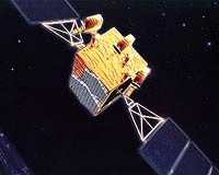
The global navigation system Glonass should be cheaper and of better quality than the GPS system, Russian President Vladimir Putin said Monday. "You know what attention I pay to Glonass, and I hope relevant attention will be paid to it," Putin told Cabinet members.
Glonass is a Russian version of the U.S. Global Positioning System (GPS), which is designed for both military and civilian use, and allows users to identify their positions in real time. The system can also be used in geological prospecting.
In December 2005, President Vladimir Putin ordered the system to be ready by 2008, and First Deputy Prime Minister Sergei Ivanov said Glonass would be available to domestic users for military as well civilian purposes by the end of 2007.
The head of Russia's Federal Space Agency, Anatoly Perminov, said earlier that Russia is also in talks with the United States and the European Space Agency to prepare agreements on the use of Glonass jointly with the GPS and Galileo satellite navigation systems.
The agency plans to have 18 satellites in orbit by late 2007 or early 2008, and a full orbital group of 24 satellites by the end of 2009, he said.
[img]Ivanov said late last year that Russia will lift all precision restrictions on Glonass beginning in 2007, which will enable accurate and unlimited commercial use of the military-controlled global positioning system.
Current restrictions limit the accuracy for civilian users of Glonass to 30 meters.
The first launch under the Glonass program took place October 12, 1982, but the system was only formally launched September 24, 1993.
Andrei Kozlov, the head of the Reshetnev Research and Production Center in the Siberian city of Krasnoyarsk, Russia's leading spacecraft manufacturer, said earlier the Glonass system currently has 13 satellites in orbit.
The satellites currently in use are of two modifications - Glonass and its updated version Glonass-M. Glonass-M has a longer service life of seven years and is equipped with updated antenna feeder systems and an additional navigation frequency for civilian users.
A future modification, Glonass-K, is an entirely new model based on a non-pressurized platform, standardized to the specifications of the previous models' platform, Express-1000.
Glonass-Ks' estimated service life has been increased to 10-12 years, and a third "civilian" L-range frequency has been added.
Tests on Glonass-K satellites are scheduled for 2007.
Source: http://www.gpsdaily.com/reports/Glonass_Cheaper_To_Build_Than_GPS_Says_Putin_999.html
Friday, April 20, 2007
Switzerland Upgrades its Nationwide Positioning Network with Trimble GNSS Infrastructure Technology
 SUNNYVALE, Calif., April 17, 2007 -- Trimble (NASDAQ:TRMB) announced today it has supplied 31 Trimble NetR5™ GNSS reference stations and Trimble Zephyr Geodetic™ 2 antennas to Switzerlands Federal Office for Topography (swisstopo) to upgrade its nationwide positioning network with Global Satellite Navigation System (GNSS) capabilities. The permanent geospatial infrastructure will support satellite signals from GPS and GLONASS, significantly optimizing real-time kinematic (RTK) positioning performance for surveying, engineering and Geographic Information System (GIS) professionals.
 Known as AGNES (Automated GPS Network for Switzerland), the Swiss infrastructure enables swisstopo to provide the Swiss Positioning Service (swipos), which supplies RTK GPS and Differential Global Positioning System (DGPS) corrections to users of the network. By implementing Trimble NetR5 GNSS reference stations, which support the modernized GPS L2C and L5 signals as well as GLONASS L1/L2 signals, the network will be upgraded and called AGNES II. In addition, the selection of the new Trimble Zephyr Geodetic 2 antennas provides AGNES II compatibility with future planned constellations and frequencies.
Originally built in 1999 with Trimble GPS receivers, the network covers the entire 41,000 square kilometers (25, 476 square miles) of Switzerland, which is known for its extreme topography ranging from mountains over 4,000 meters (13,123 feet) high to its lowest lake at 193 meters (633 feet). Users of AGNES II will be able to optimize positioning performance particularly in reception-critical areas, such as areas with interrupted reception and zones with extreme topographic features.
In addition, the use of Trimble RTKNet™ software provides AGNES II with Trimble VRS™ (Virtual Reference Station) functionality, which computes a virtual reference station for the user in the field, increasing system reliability and allowing significantly greater distances between reference stations. The VRS network will provide a highly reliable, cost-effective means for surveyors and other professionals to work faster and achieve more accurate GNSS results.
The AGNES II network is designed to cover the needs of swisstopo into the future and will enable accurate and reliable centimeter-level surveying measurements to be taken faster and more cost-effectively throughout Switzerland. AGNES II is expected to be fully operational by summer of 2007.
The nationwide Swiss VRS network follows more than 80 Trimble infrastructure installations networks throughout the world including: Australia, Austria, Belgium, Canada, Czech Republic, China, Denmark, Finland, France, Germany, Greece, Italy, Japan, Kingdom of Saudi Arabia, Lithuania, Malaysia, Netherlands, New Caledonia, Norway, Poland, Portugal, Republic of South Africa, Serbia, Singapore, Slovenia, Slovakia, South Korea, Spain, Sweden, Switzerland, Taiwan, United Kingdom and U.S. For a partial reference list of Trimble VRS installations visit: http://www.trimble.com/vrsinstallations.shtml.
About swisstopo
Established in 1893, Switzerland's Federal Office of Topography (swisstopo) is responsible for all geographical reference data and products. Swisstopo creates and maintains the geodetic, topographic and geological data for Switzerland including publishing the national map series at a variety of scales and keeping them current. Swisstopo's Federal Directorate of Cadastral Surveying division oversees the official cadastral survey, providing the measurement and mapping for the national land register. Swisstopo forms part of the armasuisse group within the Federal Department of Defense, Civil Protection and Sport (DDPS). For more information, visit: http://www.swisstopo.ch/en
About Trimble VRS Technology
Trimble VRS technology uses the RTK solutions from Trimble RTKNet software and provides high-accuracy, RTK GNSS positioning for wider areas. The VRS network is available at any time without the need for field base stations and provides common control anywhere in the network.
Because Trimble RTKNet software is able to process the entire network simultaneously, Trimble VRS networks offer greater quality control and higher data accuracy at longer distances. In the field, the farther users get from a reference station using conventional RTK, the more susceptible they become to reduced accuracy and performance due to systematic errors such as ionospheric and tropospheric effects. In a Trimble VRS network, RTKNet software provides a fully modeled solution that factor in potential systematic errors. Users connect into the system using a wireless connection; the software acknowledges the users field positions and allows them to operate as though there is a reference station—a virtual reference station—right next to their rover. As a result, the PPM error is eliminated or significantly reduced, allowing surveyors to achieve RTK precision over much greater distances with fewer reference stations. Users can also retrieve stored GNSS and modeled data from the control center via the Internet for post-processing.
About Trimble's Engineering and Construction Business
Trimble, a world leader in GPS, construction lasers, robotic total stations and machine control solutions, is creating a broad range of innovative solutions that change the way construction work is done. The Engineering and Construction business of Trimble is focusing on the development of technology and solutions in the core areas of surveying, construction and infrastructure. From concept to completion, Trimble's integrated systems streamline jobs and improve productivity.
About Trimble
Trimble applies technology to make field and mobile workers in businesses and government significantly more productive. Solutions are focused on applications requiring position or location—including surveying, construction, agriculture, fleet and asset management, public safety and mapping. In addition to utilizing positioning technologies, such as GPS, lasers and optics, Trimble solutions may include software content specific to the needs of the user. Wireless technologies are utilized to deliver the solution to the user and to ensure a tight coupling of the field and the back office. Founded in 1978 and headquartered in Sunnyvale, Calif., Trimble has a worldwide presence with more than 3,400 employees in over 18 countries.
For more information Trimbles Web site at www.trimble.com.
Certain statements made in this press release are forward looking statements within the meaning of Section 27A of the Securities Act of 1933 and Section 21E of the Securities Exchange Act of 1934, and are made pursuant to the safe harbor provisions of the Securities Litigation Reform Act of 1995. These statements involve risks and uncertainties, and actual events and results may differ materially from those described in this press release. Factors that could cause or contribute to such differences include, but are not limited to: the reception, cost-effectiveness and performance of the AGNES II network; the future compatibility of the network with changing technologies and ability of the network to meet the future needs of swisstopo and its professional end-users; the operational launch date of the network; and the impact of competing networks and technologies. More information about potential factors which could affect Trimbles business and financial results is set forth in reports filed with the SEC, including Trimble's quarterly reports on Form 10-Q and its annual report on Form 10-K. All forward looking statements are based on information available to Trimble as of the date hereof, and Trimble assumes no obligation to update such statements.
Investor Relations Contact: Willa McManmon of Trimble: 408-481-7838
Media Contact: LeaAnn McNabb of Trimble: 408-481-7808
Source: http://www.trimble.com/news/release.aspx?id=041707a
Friday, April 13, 2007
China launches navigation satellite
BEIJING - A Chinese rocket placed a navigation satellite in orbit Saturday as part of an effort to build a global positioning system, the official Xinhua News Agency reported.
The satellite was the fourth China has launched as part of its Compass navigation system, which will provide the country with navigation and positioning services beginning in 2008, Xinhua said.
A decade ago China grew worried about dependence on the U.S. satellite Global Positioning System network, the dominant positioning system, and began to develop alternatives. Besides the Compass system, China is investing in the European Union ‘s Galileo satellite navigation system and is talking about participating in Russia‘s GLONASS.
Source: Local News Watch
The satellite was the fourth China has launched as part of its Compass navigation system, which will provide the country with navigation and positioning services beginning in 2008, Xinhua said.
A decade ago China grew worried about dependence on the U.S. satellite Global Positioning System network, the dominant positioning system, and began to develop alternatives. Besides the Compass system, China is investing in the European Union ‘s Galileo satellite navigation system and is talking about participating in Russia‘s GLONASS.
Source: Local News Watch
Wednesday, April 11, 2007
Navigation satellite wars
GPS is not the only global navigation satellite system out there, at least not for long. There are other nations trying to break their dependence from USA’s globally available free service - which can be shut down at will of U.S. military. Not to mention GPS (Navstar) is aging (even older than 1st generation iPods!!!) fast and it needs some serious upgrading.
 European Union - Galileo
Initiated in 1999, Galileo is a joint effort of European countries. When first started, the U.S. opposed the plans stating that it would end their ability to control positioning satellites in military conflict scenarios. The pressure from the U.S. backfired and as a result the Galileo project was over-funded by European nations who decided it was crucial to be independent of U.S. controlled GPS.
The total cost of the system is expected to be around €3 billions. Galileo is funded by EU nations and China.
Primarily intended for civilians, Galileo will support different kinds of services: OS (open service) will broadcast in two bands (1164–1214 MHz and at 1563–1591 MHz) and when both are used you’ll be able to get <4 meter accuracy. CS (commercial service) will require a fee but if used with ground stations it will be able provide accuracy of less than 10 cm’s. It will use an extra band at 1260–1300 MHz in addition to the OS frequencies.
* Number of satellites: 30
* Completion Date: 2011
* Current Status: First satellite launched in December 2005 and first ‘Galileo’ signal received in January 2006.
 China - Beidou
China’s Beidou was first planned to be used for military purposes but Chinese government has already announced it will be free for civilians as well. This would conflict with EU’s Galileo which plans to profit from selling of receivers and subscriptions to benefit from high accuracy signals.
* Completion Date: Coverage of China and neighbors by 2008 - global coverage in later years
* Number of satellites: 35
* Current Status: 4 satellites in orbit
 Russia - Glonass
Russia’s Glonass has a long history which goes as far back as the peak of Cold War. The Glonass system has never been globally available since then, mostly due to instability in Soviet Union and current Russia. India, and possibly China, collaborate with Russia on Glonass. Since 1992 Russia has launched 44 satellites, some of which are no longer in service. Glonass’ civilian signal - which is only available half the time in Russia, and less globally - can provide <100 meters of accuracy. Military signals are better, providing accuracy of <15 meters. Russia has announced that it would make military grade signals available this year.
* Completion Date: 2011
* Number of satellites: 24
* Current Status: 16 in orbit, 5 of which is switched off. 12 more scheduled to be in orbit in the next two years
 India - IRNSS
Indian Regional Navigation Satellite System, IRNSS, was recently approved with a budget just over $300 million. IRNSS is planned to provide only regional coverage provided by 7 satellites.
* Number of satellites: 7
* Completion Date: 2011
* Current Status: First satellite to be launched in 2008
 USA - Navstar (GPS)
It is the only fully functional, globally available navigation satellite system so far. It is free for everybody on this planet. The first one of the satellites was launched in 1978 and the system has benn fully operational since 1995. However the satellites get old and need to be replaced and technological advancements require GPS to be upgraded.
The modernization has been approved since 2000 and is called GPS III. The new system will provide capabilities such as to shut off GPS service to a limited geographical location while providing GPS to US forces. The new GPS III satellites will still provide legacy capabilities while adding high-powered, anti-jam military-code signals.
These satellites will have about 500 times the transmitter power of the current system, multiplying its resistance to jamming. With a constellation of 30-32 satellites, GPS III will have second and third frequencies to contain civilian signal, L2 & L5, more robust signal transmissions, and provide real-time unaugmented 1 meter accuracy.
Completion Date: 2011
Number of satellites: 24+
Current Status: Fully functional, upgrade in process
Cource: Navigadget
 European Union - Galileo
Initiated in 1999, Galileo is a joint effort of European countries. When first started, the U.S. opposed the plans stating that it would end their ability to control positioning satellites in military conflict scenarios. The pressure from the U.S. backfired and as a result the Galileo project was over-funded by European nations who decided it was crucial to be independent of U.S. controlled GPS.
The total cost of the system is expected to be around €3 billions. Galileo is funded by EU nations and China.
Primarily intended for civilians, Galileo will support different kinds of services: OS (open service) will broadcast in two bands (1164–1214 MHz and at 1563–1591 MHz) and when both are used you’ll be able to get <4 meter accuracy. CS (commercial service) will require a fee but if used with ground stations it will be able provide accuracy of less than 10 cm’s. It will use an extra band at 1260–1300 MHz in addition to the OS frequencies.
* Number of satellites: 30
* Completion Date: 2011
* Current Status: First satellite launched in December 2005 and first ‘Galileo’ signal received in January 2006.
 China - Beidou
China’s Beidou was first planned to be used for military purposes but Chinese government has already announced it will be free for civilians as well. This would conflict with EU’s Galileo which plans to profit from selling of receivers and subscriptions to benefit from high accuracy signals.
* Completion Date: Coverage of China and neighbors by 2008 - global coverage in later years
* Number of satellites: 35
* Current Status: 4 satellites in orbit
 Russia - Glonass
Russia’s Glonass has a long history which goes as far back as the peak of Cold War. The Glonass system has never been globally available since then, mostly due to instability in Soviet Union and current Russia. India, and possibly China, collaborate with Russia on Glonass. Since 1992 Russia has launched 44 satellites, some of which are no longer in service. Glonass’ civilian signal - which is only available half the time in Russia, and less globally - can provide <100 meters of accuracy. Military signals are better, providing accuracy of <15 meters. Russia has announced that it would make military grade signals available this year.
* Completion Date: 2011
* Number of satellites: 24
* Current Status: 16 in orbit, 5 of which is switched off. 12 more scheduled to be in orbit in the next two years
 India - IRNSS
Indian Regional Navigation Satellite System, IRNSS, was recently approved with a budget just over $300 million. IRNSS is planned to provide only regional coverage provided by 7 satellites.
* Number of satellites: 7
* Completion Date: 2011
* Current Status: First satellite to be launched in 2008
 USA - Navstar (GPS)
It is the only fully functional, globally available navigation satellite system so far. It is free for everybody on this planet. The first one of the satellites was launched in 1978 and the system has benn fully operational since 1995. However the satellites get old and need to be replaced and technological advancements require GPS to be upgraded.
The modernization has been approved since 2000 and is called GPS III. The new system will provide capabilities such as to shut off GPS service to a limited geographical location while providing GPS to US forces. The new GPS III satellites will still provide legacy capabilities while adding high-powered, anti-jam military-code signals.
These satellites will have about 500 times the transmitter power of the current system, multiplying its resistance to jamming. With a constellation of 30-32 satellites, GPS III will have second and third frequencies to contain civilian signal, L2 & L5, more robust signal transmissions, and provide real-time unaugmented 1 meter accuracy.
Completion Date: 2011
Number of satellites: 24+
Current Status: Fully functional, upgrade in process
Cource: Navigadget
Monday, April 9, 2007
GPS/GLONASS Interoperability and Compatibility Joint Statement
The meeting (December 14, 2006) was highly successful and resolved many questions regarding interoperability and compatibility between the GPS and GLONASS systems.
Download or view the document in PDF: http://www.glonass-ianc.rsa.ru/i/glonass/joint_statement_eng.pdf
Source: http://www.glonass-ianc.rsa.ru/pls/htmldb/f?p=202:1:17793156227589262252
Download or view the document in PDF: http://www.glonass-ianc.rsa.ru/i/glonass/joint_statement_eng.pdf
Source: http://www.glonass-ianc.rsa.ru/pls/htmldb/f?p=202:1:17793156227589262252
TeKnol Ltd. --- innovative navigation, inertial reference and air data sensor integration technology firm
TeKnol Ltd. is an independent, privately held company headquartered in Moscow, Russia. It was founded in 2003 by a group of scientists, engineers and investors with the goal of commercializing analytic sensor fusion algorithms technology developed, tested and refined by key members of the group over several years.
By 2006 TeKnol became an innovative navigation, inertial reference and air data sensor integration technology firm, engaged in development, design, manufacturing, marketing, sales and support of ultra-compact low-cost inertial navigation systems (INS) integrated with Global Navigation Satellite System (GPS, GLONASS) for aviation, land and industrial applications.
We not only bring to the market our innovative end-user products, which enable real-time vehicle or person positioning, heading, attitude and acceleration determination, but offer customized INS and smart sensors solutions for third-party integration.
All our products are commercially available, maintenance free, industrially made with standard quality control and customer-friendly warranty policy. We provide our customers with long-term support.
 Our "flagship" end-user product is PGC-A - Autonomous Portable Glass Cockpit System with perspective flight guidance, based on our Compact Integrated Navigation System (CINS), and proprietary "Pictorial Indication" software.
Other products include but are not limited to unmanned air vehicle (UAV) Flight Control System, flight data recorder, land-based navigation and motion sensing.
TeKnol website: http://www.teknol.ru/eng/
By 2006 TeKnol became an innovative navigation, inertial reference and air data sensor integration technology firm, engaged in development, design, manufacturing, marketing, sales and support of ultra-compact low-cost inertial navigation systems (INS) integrated with Global Navigation Satellite System (GPS, GLONASS) for aviation, land and industrial applications.
We not only bring to the market our innovative end-user products, which enable real-time vehicle or person positioning, heading, attitude and acceleration determination, but offer customized INS and smart sensors solutions for third-party integration.
All our products are commercially available, maintenance free, industrially made with standard quality control and customer-friendly warranty policy. We provide our customers with long-term support.
 Our "flagship" end-user product is PGC-A - Autonomous Portable Glass Cockpit System with perspective flight guidance, based on our Compact Integrated Navigation System (CINS), and proprietary "Pictorial Indication" software.
Other products include but are not limited to unmanned air vehicle (UAV) Flight Control System, flight data recorder, land-based navigation and motion sensing.
TeKnol website: http://www.teknol.ru/eng/
GPS Receivers For Pets
 Russian science and research institute of space instrument-making is going to start developing GLONASS/GPS receivers for monitoring pets this year.
The devices, fastened on dogs' backs aren't in production yet, however, designers plan to start developing electronic shepherds as soon as this year. Western analogs cost over $600, thus Russian dog and cat owners would have to pay the equivalent in Russian rubles.
Scientists say that about 20 Russian companies produce terrestrial navigation devices for civil GLONASS/GPS users, thus creating stiff competition, especially in those units, designed only for one of mentioned navigation system.
Source: http://www.russia-ic.com/news/show/3766/
Tuesday, April 3, 2007
Russia Challenges the U.S. Monopoly on Satellite Navigation
MOSCOW, April 3 — The days of their cold war may have passed, but Russia and the United States are in the midst of another battle — this one a technological fight over the United States monopoly on satellite navigation.

A fabrication room at the Russian Institute of Radionavigation
and Time in St. Petersburg, a manufacturer of satellite navigation devices.
By the end of the year, the authorities here say, the Russian space agency plans to launch eight navigation satellites that would nearly complete the country’s own system, called Glonass, for Global Navigation Satellite System.
The system is expected to begin operating over Russian territory and parts of adjacent Europe and Asia, and then go global in 2009 to compete with the Global Positioning System of the United States.
Nor is Russia the only country trying to break the American monopoly on navigation technology. China has already sent up satellites to create its own system, called Baidu after the Chinese word for the Big Dipper. And the European Union has also begun developing a rival system, Galileo, although work has been halted because of doubts among the private contractors over its potential for profits. Russia’s system is furthest along, paid for with government oil revenue.
What is driving the technological battle is, in part, the potential for many more uses for satellite navigation than the one most people know it for — giving driving instructions to travelers. Businesses as disparate as agriculture and banking are integrating it into their operations. Satellite navigation may provide the platform for services like site-specific advertising, with directions that appear on cellphone screens when a user is walking, for example, near a Starbucks coffee shop or a McDonald’s restaurant.
Sales of G.P.S. devices are already booming. The global market for the devices hit $15 billion in 2006, according to the GPS Industry Council, a Washington trade group, and is expanding at a rate of 25 to 30 percent annually.
But what is also behind the battle for control of navigation technology is a fear that the United States could use its monopoly — the system was developed and is controlled by the military, after all — to switch off signals in a time of crisis.
“In a few years, business without a navigation signal will become inconceivable,” said Andrei G. Ionin, an aerospace analyst with the Center for the Analysis of Strategies and Technologies, which is linked to the Russian defense ministry. “Everything that moves will use a navigation signal — airplanes, trains, yachts, people, rockets, valuable animals and favorite pets.”

Devices like chips and receivers are made The Russian Institute
of Radionavigation and Time.
When that happens, countries that choose to rely only on G.P.S., he said, will be falling into “a geopolitical trap” of American dominance of an important Internet-age infrastructure. The United States could theoretically deny navigation signals to countries like Iran and North Korea, not just in time of war, but as a high-tech form of economic sanction that could disrupt power grids, banking systems and other industries, he said. The United States government’s stated policy is to provide uninterrupted signals globally.
G.P.S. devices, in fact, are at the center of the dispute over the Iranian seizure of 15 British sailors and marines. The British maintain that the devices on their boats showed they were in Iraqi waters; the Iranians have countered with map coordinates that it said showed they had been in Iranian waters.
Russia’s project, of course, carries wide implications for armies around the world by providing a navigation system not controlled by the Pentagon, complementing Moscow’s increasingly assertive foreign policy stance.
The United States formally opened G.P.S. to civilian users in 1993 by promising to provide it continually, at no cost, around the world.
The Russian system is also calculated to send ripples through the fast-expanding industry for consumer navigation devices by promising a slight technical advantage over G.P.S. alone, analysts and industry executives say. Devices receiving signals from both systems would presumably be more reliable.
President Vladimir V. Putin, who speaks often about Glonass and its possibilities, has prodded his scientists to make the product consumer friendly.
“The network must be impeccable, better than G.P.S., and cheaper if we want clients to choose Glonass,” Mr. Putin said last month at a Russian government meeting on the system, according to the Interfax news agency.
“You know how much I care about Glonass,” Mr. Putin told his ministers.
G.P.S. has its roots in the American military in the 1960s. In 1983, before the system was fully functional, President Ronald Reagan suggested making it available to civilian users around the world after a Korean Air flight strayed into Soviet airspace and was shot down.
G.P.S. got its first military test in the Persian Gulf war in 1991, and was seen as a big reason for the success of the precision bombing campaign, which helped spur its adoption in commercial applications in the 1990s.
The Russian system, like America’s G.P.S., has roots in the cold war technology to guide strategic bombers and missiles. It was briefly operational in the mid-1990s, but fell into disrepair. The Russian satellites send signals that are usable now but work only intermittently.
To operate globally, a system needs a minimum of 24 satellites, the number in the G.P.S. constellation, not counting spares in orbit.
A receiver must be in line of sight of no fewer than three satellites at any time to triangulate an accurate position. A fourth satellite is needed to calculate altitude. As other countries introduce competing systems, devices capable of receiving foreign signals along with G.P.S. will more often be in line of sight of three or more satellites.
Within the United States, Western Europe and Japan, ground-based transmissions hone the accuracy of signals to within a few feet of a location — better than what could be achieved with satellite signals alone. The Russian and eventual European or Chinese systems, therefore, would make receivers more reliable in preventing signal loss when there are obstructions, like steep canyons, tall buildings or even trees.
Still, a Glonass-capable G.P.S. receiver in the United States, Western Europe or Japan would not be more accurate than a G.P.S. system alone, because of the ground-based correction signals. In other parts of the world, a Glonass-capable G.P.S. receiver would be more reliable and slightly more accurate.
American manufacturers that are dominant in the industry could be confronted with pressure to offer these advantages to customers by making devices compatible with the Russian system, inevitably undermining the American monopoly on navigation signals used in commerce.
In this sense, the Russians are setting off the first salvo in a battle for an infrastructure in the skies. Russia sees a great deal at stake in influencing the standards that will be used in civilian consumer devices.
The market for satellite navigators is growing rapidly. Garmin, the largest American manufacturer, more than doubled sales of automobile navigators in 2006, for example, and in February it showed a Super Bowl ad that was seen as a coming of age for G.P.S. navigators as a mass market product.
Jeremy D. Ludwig was one consumer who said he would be willing to pay a slight premium for a device equipped with a chip capable of processing Russian navigation signals.
He recounted a recent trip on Interstate 25 in Colorado, when, he said, he was dismayed to discover the G.P.S. device on his BlackBerry had inexplicably lost its signal, just as he was trying to decide which exit to take into Denver.
“If you don’t know which exit to take, you’re already lost,” Mr. Ludwig, an art student, said in a recent telephone interview from Colorado Springs.
That kind of attitude is what Russia is banking on even as it also takes a stab at making consumer receivers — so far without much success. But the Russian goal of diversifying navigation signals used in commerce will be achieved, Mr. Ionin said, even if foreign manufacturers simply adopt the Russian standard, and even if Russia’s own attempt to make consumer devices fails.
To encourage wide acceptance, Mr. Putin has been pitching the system during foreign visits, asking for collaboration and financial support.
Now, only makers of high-end surveying and professional navigation receivers have adopted dual-system capability.
Topcon Positioning Systems of Livermore, Calif., for example, offers a Glonass and G.P.S. receiver for surveyors and heavy-equipment operators. Javad Navigation Systems is built around making dual-system receivers, with offices in San Jose and Moscow.
Javad Ashjaee, the president of Javad, said in an interview that wide adoption was inevitable because more satellites provided an inherently better service. “If you have G.P.S., you have 90 percent of what you need,” he said. Russia’s system will succeed, he said, “for that extra 10 percent.”
Adding Glonass to low-end consumer devices would require a new chip, with associated design costs, but probably not much in the way of additional manufacturing expenses, he said.
Already this year, in a sign of growing acceptance of Glonass, another high-end manufacturer, Trimble, based in Sunnyvale, Calif., introduced a Russian-compatible device for agricultural navigators, used for applying pesticides, for example.
Whether consumer goods manufacturers will follow is an open question, John R. Bucher, a wireless equipment analyst at BMO Capital Markets, said in a telephone interview.
Garmin, which has more than 50 percent of the American market, has not yet taken a position on Glonass. “We are waiting,” Jessica Myers, a spokeswoman for Garmin, said in a telephone interview.
For most consumers, she said, devices are reliable enough already. Growth in the industry is driven instead by better digital mapping and software, making what already exists more useful. Garmin’s latest car navigator, for example, alerts drivers to traffic jams on the road ahead and the price of gas at nearby stations.
At home at least, the Kremlin is guaranteeing a market by requiring ships, airplanes and trucks carrying hazardous materials to operate with Glonass receivers, while providing grants to half a dozen Russian manufacturers of navigators.
Technically precise they may be, but even by Russian standards, some of the Russian-made products coming to market now are noticeably lacking in convenience features.
At the Russian Institute of Radionavigation and Time in St. Petersburg, for example, scientists have developed the M-103 dual system receiver. The precision device theoretically operates more reliably than a G.P.S. unit under tough conditions, like the urban canyons of Manhattan.
With its boxy appearance, the M-103 resembles a Korean War-era military walkie-talkie. It weighs about one pound and sells for $1,000, display screen not included. To operate, a user must unfurl a cable linking the set to an external antenna mounted on a spiked stick, intended to be jabbed into a field.
“Unfortunately, we haven’t developed a hand-held version yet,” said Vadim S. Zholnerov, a deputy director of the institute.
Source: http://www.nytimes.com/2007/04/04/business/worldbusiness/04gps.html?ref=worldbusiness

A fabrication room at the Russian Institute of Radionavigation
and Time in St. Petersburg, a manufacturer of satellite navigation devices.
By the end of the year, the authorities here say, the Russian space agency plans to launch eight navigation satellites that would nearly complete the country’s own system, called Glonass, for Global Navigation Satellite System.
The system is expected to begin operating over Russian territory and parts of adjacent Europe and Asia, and then go global in 2009 to compete with the Global Positioning System of the United States.
Nor is Russia the only country trying to break the American monopoly on navigation technology. China has already sent up satellites to create its own system, called Baidu after the Chinese word for the Big Dipper. And the European Union has also begun developing a rival system, Galileo, although work has been halted because of doubts among the private contractors over its potential for profits. Russia’s system is furthest along, paid for with government oil revenue.
What is driving the technological battle is, in part, the potential for many more uses for satellite navigation than the one most people know it for — giving driving instructions to travelers. Businesses as disparate as agriculture and banking are integrating it into their operations. Satellite navigation may provide the platform for services like site-specific advertising, with directions that appear on cellphone screens when a user is walking, for example, near a Starbucks coffee shop or a McDonald’s restaurant.
Sales of G.P.S. devices are already booming. The global market for the devices hit $15 billion in 2006, according to the GPS Industry Council, a Washington trade group, and is expanding at a rate of 25 to 30 percent annually.
But what is also behind the battle for control of navigation technology is a fear that the United States could use its monopoly — the system was developed and is controlled by the military, after all — to switch off signals in a time of crisis.
“In a few years, business without a navigation signal will become inconceivable,” said Andrei G. Ionin, an aerospace analyst with the Center for the Analysis of Strategies and Technologies, which is linked to the Russian defense ministry. “Everything that moves will use a navigation signal — airplanes, trains, yachts, people, rockets, valuable animals and favorite pets.”

Devices like chips and receivers are made The Russian Institute
of Radionavigation and Time.
When that happens, countries that choose to rely only on G.P.S., he said, will be falling into “a geopolitical trap” of American dominance of an important Internet-age infrastructure. The United States could theoretically deny navigation signals to countries like Iran and North Korea, not just in time of war, but as a high-tech form of economic sanction that could disrupt power grids, banking systems and other industries, he said. The United States government’s stated policy is to provide uninterrupted signals globally.
G.P.S. devices, in fact, are at the center of the dispute over the Iranian seizure of 15 British sailors and marines. The British maintain that the devices on their boats showed they were in Iraqi waters; the Iranians have countered with map coordinates that it said showed they had been in Iranian waters.
Russia’s project, of course, carries wide implications for armies around the world by providing a navigation system not controlled by the Pentagon, complementing Moscow’s increasingly assertive foreign policy stance.
The United States formally opened G.P.S. to civilian users in 1993 by promising to provide it continually, at no cost, around the world.
The Russian system is also calculated to send ripples through the fast-expanding industry for consumer navigation devices by promising a slight technical advantage over G.P.S. alone, analysts and industry executives say. Devices receiving signals from both systems would presumably be more reliable.
President Vladimir V. Putin, who speaks often about Glonass and its possibilities, has prodded his scientists to make the product consumer friendly.
“The network must be impeccable, better than G.P.S., and cheaper if we want clients to choose Glonass,” Mr. Putin said last month at a Russian government meeting on the system, according to the Interfax news agency.
“You know how much I care about Glonass,” Mr. Putin told his ministers.
G.P.S. has its roots in the American military in the 1960s. In 1983, before the system was fully functional, President Ronald Reagan suggested making it available to civilian users around the world after a Korean Air flight strayed into Soviet airspace and was shot down.
G.P.S. got its first military test in the Persian Gulf war in 1991, and was seen as a big reason for the success of the precision bombing campaign, which helped spur its adoption in commercial applications in the 1990s.
The Russian system, like America’s G.P.S., has roots in the cold war technology to guide strategic bombers and missiles. It was briefly operational in the mid-1990s, but fell into disrepair. The Russian satellites send signals that are usable now but work only intermittently.
To operate globally, a system needs a minimum of 24 satellites, the number in the G.P.S. constellation, not counting spares in orbit.
A receiver must be in line of sight of no fewer than three satellites at any time to triangulate an accurate position. A fourth satellite is needed to calculate altitude. As other countries introduce competing systems, devices capable of receiving foreign signals along with G.P.S. will more often be in line of sight of three or more satellites.
Within the United States, Western Europe and Japan, ground-based transmissions hone the accuracy of signals to within a few feet of a location — better than what could be achieved with satellite signals alone. The Russian and eventual European or Chinese systems, therefore, would make receivers more reliable in preventing signal loss when there are obstructions, like steep canyons, tall buildings or even trees.
Still, a Glonass-capable G.P.S. receiver in the United States, Western Europe or Japan would not be more accurate than a G.P.S. system alone, because of the ground-based correction signals. In other parts of the world, a Glonass-capable G.P.S. receiver would be more reliable and slightly more accurate.
American manufacturers that are dominant in the industry could be confronted with pressure to offer these advantages to customers by making devices compatible with the Russian system, inevitably undermining the American monopoly on navigation signals used in commerce.
In this sense, the Russians are setting off the first salvo in a battle for an infrastructure in the skies. Russia sees a great deal at stake in influencing the standards that will be used in civilian consumer devices.
The market for satellite navigators is growing rapidly. Garmin, the largest American manufacturer, more than doubled sales of automobile navigators in 2006, for example, and in February it showed a Super Bowl ad that was seen as a coming of age for G.P.S. navigators as a mass market product.
Jeremy D. Ludwig was one consumer who said he would be willing to pay a slight premium for a device equipped with a chip capable of processing Russian navigation signals.
He recounted a recent trip on Interstate 25 in Colorado, when, he said, he was dismayed to discover the G.P.S. device on his BlackBerry had inexplicably lost its signal, just as he was trying to decide which exit to take into Denver.
“If you don’t know which exit to take, you’re already lost,” Mr. Ludwig, an art student, said in a recent telephone interview from Colorado Springs.
That kind of attitude is what Russia is banking on even as it also takes a stab at making consumer receivers — so far without much success. But the Russian goal of diversifying navigation signals used in commerce will be achieved, Mr. Ionin said, even if foreign manufacturers simply adopt the Russian standard, and even if Russia’s own attempt to make consumer devices fails.
To encourage wide acceptance, Mr. Putin has been pitching the system during foreign visits, asking for collaboration and financial support.
Now, only makers of high-end surveying and professional navigation receivers have adopted dual-system capability.
Topcon Positioning Systems of Livermore, Calif., for example, offers a Glonass and G.P.S. receiver for surveyors and heavy-equipment operators. Javad Navigation Systems is built around making dual-system receivers, with offices in San Jose and Moscow.
Javad Ashjaee, the president of Javad, said in an interview that wide adoption was inevitable because more satellites provided an inherently better service. “If you have G.P.S., you have 90 percent of what you need,” he said. Russia’s system will succeed, he said, “for that extra 10 percent.”
Adding Glonass to low-end consumer devices would require a new chip, with associated design costs, but probably not much in the way of additional manufacturing expenses, he said.
Already this year, in a sign of growing acceptance of Glonass, another high-end manufacturer, Trimble, based in Sunnyvale, Calif., introduced a Russian-compatible device for agricultural navigators, used for applying pesticides, for example.
Whether consumer goods manufacturers will follow is an open question, John R. Bucher, a wireless equipment analyst at BMO Capital Markets, said in a telephone interview.
Garmin, which has more than 50 percent of the American market, has not yet taken a position on Glonass. “We are waiting,” Jessica Myers, a spokeswoman for Garmin, said in a telephone interview.
For most consumers, she said, devices are reliable enough already. Growth in the industry is driven instead by better digital mapping and software, making what already exists more useful. Garmin’s latest car navigator, for example, alerts drivers to traffic jams on the road ahead and the price of gas at nearby stations.
At home at least, the Kremlin is guaranteeing a market by requiring ships, airplanes and trucks carrying hazardous materials to operate with Glonass receivers, while providing grants to half a dozen Russian manufacturers of navigators.
Technically precise they may be, but even by Russian standards, some of the Russian-made products coming to market now are noticeably lacking in convenience features.
At the Russian Institute of Radionavigation and Time in St. Petersburg, for example, scientists have developed the M-103 dual system receiver. The precision device theoretically operates more reliably than a G.P.S. unit under tough conditions, like the urban canyons of Manhattan.
With its boxy appearance, the M-103 resembles a Korean War-era military walkie-talkie. It weighs about one pound and sells for $1,000, display screen not included. To operate, a user must unfurl a cable linking the set to an external antenna mounted on a spiked stick, intended to be jabbed into a field.
“Unfortunately, we haven’t developed a hand-held version yet,” said Vadim S. Zholnerov, a deputy director of the institute.
Source: http://www.nytimes.com/2007/04/04/business/worldbusiness/04gps.html?ref=worldbusiness
GLONASS-devising Russian institute marks its 50th jubilee
ST PETERSBURG, April 3 (Itar-Tass) - The Russian Institute of Radionavigation and Time marks its 50th jubilee on Tuesday. It was the Institute's scientists that devised the professional satellite-aided navigation equipment GLONASS that has been adapted to its foreign analogues, GPS/GALILEO.
A scientific conference and a ceremonial session of the Learned Council will be held at the Institute on the occasion of the jubilee.
A production line with a capacity of 10,000 instrumentation packages a year has been brought into being on the basis of the Institute, which is the Rosprom (Federal Industrial Agency) leading research center in the field of radionavigation, systems of precision time and synchronisation, an official in the jubilee events organizing committee has told Itar-Tass.
The committee official specified that a collective of scientists and specialists currently engage in "creating a single time coordinate and navigation support system".
Researchers at the Institute have also worked out more than 40 types of onboard synchronizing devices, atomic standards of frequency, and measuring instrumentation for space systems under national programmes for the development of space-based means for the observation of the Earth in the interests of defence and the national economy.
Source: http://www.itar-tass.com/eng/level2.html?NewsID=11396883&PageNum=0
A scientific conference and a ceremonial session of the Learned Council will be held at the Institute on the occasion of the jubilee.
A production line with a capacity of 10,000 instrumentation packages a year has been brought into being on the basis of the Institute, which is the Rosprom (Federal Industrial Agency) leading research center in the field of radionavigation, systems of precision time and synchronisation, an official in the jubilee events organizing committee has told Itar-Tass.
The committee official specified that a collective of scientists and specialists currently engage in "creating a single time coordinate and navigation support system".
Researchers at the Institute have also worked out more than 40 types of onboard synchronizing devices, atomic standards of frequency, and measuring instrumentation for space systems under national programmes for the development of space-based means for the observation of the Earth in the interests of defence and the national economy.
Source: http://www.itar-tass.com/eng/level2.html?NewsID=11396883&PageNum=0
Monday, April 2, 2007
Sitronics Will Partner with Chinese to Navigate by Satellite
The Russian IT company Sitronics has signed an agreement with the Chinese ZTE on the establishment of a joint enterprise to produce navigational equipment using the Russian GLONASS satellite system. Analysts say that the market for navigational services is growing leaps and bounds in Russia. Turnover on that market amounted to $50 million last year, a full six time greater than the previous year. The same analysts warn, however, that the new company will need major state orders to turn a profit.

Russian First Deputy Prime Minister Dmitry Medvedev visits Sitronics company office.
The agreement between the Chinese and AFL Sistema's IT division was timed to the visit of Chinese President Hu Jintao. The agreement envisages the establishment of a research center for the development of household appliance in Zelenograd. The appliances developed will be manufactured in China. There is a separate point in the agreement on the establishment of a joint enterprise to produce GLONASS navigation equipment. Neither the timeline nor the budget for the projects has been made public.
ZTE is one of the world's largest manufacturers of telecommunication s equipment. The Chinese government owns 51.8 percent of the stock in ZTE, and another 37.7 percent of it trades on the Hong Kong and Shanghai stock exchanges. The company's proceeds for the first nine months of 2006 were $2.013 billion. The company's capitalization as of March 25, 2007, was $4.643 billion.
The Russian GLONASS (Global Navigational Satellite System) is the only competitor to the American GPS (Global Position) system in the world today. The Russia system is supposed to come online at the end of this year, after the launch of the 18th GLONASS-M satellite. Then the owners of a GLONASS navigational systems will be able to determine their positions within Russia to an accuracy of 10-15 km. The system will be available worldwide by the end of 2009, when 24 satellites will have been launched.
Analysts expect the Russian government alone to buy 700,000 GLONASS navigators.
Source: www.kommersant.com

Russian First Deputy Prime Minister Dmitry Medvedev visits Sitronics company office.
The agreement between the Chinese and AFL Sistema's IT division was timed to the visit of Chinese President Hu Jintao. The agreement envisages the establishment of a research center for the development of household appliance in Zelenograd. The appliances developed will be manufactured in China. There is a separate point in the agreement on the establishment of a joint enterprise to produce GLONASS navigation equipment. Neither the timeline nor the budget for the projects has been made public.
ZTE is one of the world's largest manufacturers of telecommunication s equipment. The Chinese government owns 51.8 percent of the stock in ZTE, and another 37.7 percent of it trades on the Hong Kong and Shanghai stock exchanges. The company's proceeds for the first nine months of 2006 were $2.013 billion. The company's capitalization as of March 25, 2007, was $4.643 billion.
The Russian GLONASS (Global Navigational Satellite System) is the only competitor to the American GPS (Global Position) system in the world today. The Russia system is supposed to come online at the end of this year, after the launch of the 18th GLONASS-M satellite. Then the owners of a GLONASS navigational systems will be able to determine their positions within Russia to an accuracy of 10-15 km. The system will be available worldwide by the end of 2009, when 24 satellites will have been launched.
Analysts expect the Russian government alone to buy 700,000 GLONASS navigators.
Source: www.kommersant.com
Sunday, April 1, 2007
Russia’s GLONASS and Europe’s Galileo to unite against USA’s GPS
Russian global positioning system GLONASS, the world’s only functioning competitor of the US GPS, and the European system Galileo will be supplementary to each other, according to the head of the Russian Space Agency Anatoly Perminov. “We should create these systems in a way to make GLONASS and Galileo efficient and compatible”, Perminov said after the meeting with the head of the European Space Agency J.J. Dordenom and the head of the General Directorate on Business and Industry of the European Commission H. Surek.

GLONASS and Galileo vs. GPS (dutchspace.nl)
Perminov informed that the talks resulted in the agreement according to which "the work of the systems GLONASS and Galielo will be possible on the same consumers’ equipment". Within the frameworks of the agreement specific works on technical compatibility of both systems are already planned. Cooperation in satellite navigation is one of the seven directions of the cooperation between Russian and European Space Agencies.
In spite of the fact the full-fledged Russian system consisting of 24 satellites will start working globally in 2009 and the Europeans “are just in the beginning” the agreement is politically and economically advantageous for Russians. First of all it brings Russia closer to the huge and rich European market, as well as to the consumers in the regions which are oriented towards European hardware. Secondly, civil use of the navigation system is considered a bottle neck for the Russian project, therefore joining the efforts with the Europe, where satellite navigation is already widely spread, is a tangible moral support. The last but not least is that Russian and European systems together will be a far more competitive alternative to the American GPS than each system alone.
Yuri Seleznyov
Pravda.ru

GLONASS and Galileo vs. GPS (dutchspace.nl)
Perminov informed that the talks resulted in the agreement according to which "the work of the systems GLONASS and Galielo will be possible on the same consumers’ equipment". Within the frameworks of the agreement specific works on technical compatibility of both systems are already planned. Cooperation in satellite navigation is one of the seven directions of the cooperation between Russian and European Space Agencies.
In spite of the fact the full-fledged Russian system consisting of 24 satellites will start working globally in 2009 and the Europeans “are just in the beginning” the agreement is politically and economically advantageous for Russians. First of all it brings Russia closer to the huge and rich European market, as well as to the consumers in the regions which are oriented towards European hardware. Secondly, civil use of the navigation system is considered a bottle neck for the Russian project, therefore joining the efforts with the Europe, where satellite navigation is already widely spread, is a tangible moral support. The last but not least is that Russian and European systems together will be a far more competitive alternative to the American GPS than each system alone.
Yuri Seleznyov
Pravda.ru
GPS + Glonass Technolgy
Animated movie about how GPS + Glonass Technolgy works. Basic overview for how GPS technology is utilized in the field
Subscribe to:
Posts (Atom)