Mar 24, 2007
GPS World
Topcon Corp. announced it has come to a "basic agreement" to acquire Sokkia Company Limited (Sokkia). If approved by the Japanese Fair Trade Commission (FTC), Sokkia will become a Topcon subsidiary and will be renamed Sokkia Topcon. Because both companies are headquartered in Japan, the transaction is subject to approval by the Japanese FTC with respect to anti-trust regulation. Topcon states that further details will be released after the Japanese FTC has commented on the proposed acquisition.
The announcement states the reason for the merger of the two companies is to maintain an edge in the increasingly competitive worldwide surveying instruments market. Competitors Leica Geosystems AG and Trimble Navigation Ltd. have been acquiring companies to increase market strength for some time. The announcement also gives increased competition from Chinese manufacturers as another driver for the Sokkia acquisition.
Surveying instruments (Positioning Business) is the largest business segment of Topcon Corp., as it produced approximately $400 million in revenue in fiscal year 2006 (ending March 2006). Other business segments include Opthalmic/Medical, Industrial, and Optical Devices instruments. Companywide revenues for FY2006 were approximately $913 million. According to the company, it implemented a mid-term growth strategy in FY2006 targeting annual revenue of $640 million for the Positioning Business segment.
Sokkia's sole business is surveying instruments. Its worldwide FY2006 revenues for the same period were approximately $187 million.
Both companies have formidable worldwide distribution channels. No details have been released about how the acquisition will affect the two channels, although the announcement mentions that the Sokkia brand will be maintained for an interim period.
NovAtel Role. An area of ambiguity is Sokkia's joint venture with NovAtel, Inc., of Calgary, Alberta, Canada. NovAtel designs GNSS technology that Sokkia incorporates into its GNSS surveying products through a joint venture named Point, Inc., established in 1999. Sokkia owns 51 percent of Point while NovAtel owns 49 percent.
Topcon has a solid investment in GNSS technology, which began with its acquisition of the former Javad Positioning Systems in July 2000. Since FY2004, Topcon has experienced record revenues for each year and strong growth in the GNSS receiver sector, while becoming a leader in producing receivers that use both GPS and Russian GLONASS satellite signals.
Following the Topcon announcement, NovAtel CEO Jon Ladd responded that "NovAtel and Sokkia have existing contracts in place under which NovAtel develops and supplies GPS technology and products to our joint venture Point and ultimately to Sokkia. We do not expect the proposed combination of Topcon with Sokkia to affect our business relationship with Sokkia, for the foreseeable future. We continue to work with Sokkia management to develop new GNSS technology that will be incorporated into the Point/Sokkia product family." According to NovAtel, the Point agreement is effective until July 2009.
Furthermore, Hitoshi Ito, president of Sokkia Co., Ltd., stated, "We value our relationship with NovAtel and do not expect there will be a material change to our relationship."
According to NovAtel, the Point venture accounted for approximately $9 million of NovAtel's $67 million total annual revenue in FY2006.
Source: http://sc.gpsworld.com/gpssc/article/articleDetail.jsp;jsessionid=GHjkDVyTgvQmYPPVybyGxR7mGhCYWG3pJYfz1mSnhrTKbXKnj6Rv!284891640?id=414512
Sunday, May 13, 2007

Saturday, May 12, 2007
Russia in talks with other countries on joint Glonass use
MOSCOW, December 5 (RIA Novosti) - Russia is negotiating with other countries on the possible joint use of Russia's global positioning satellite system Glonass, the head of the Russian Space Agency said Tuesday.
Glonass, a Russian version of the U.S. Global Positioning System (GPS), is designed for both military and civilian purposes, and allows users to identify their positions in real time. It can also be used in geological prospecting.
"We are in active talks with India, Kazakhstan, Ukraine and other countries on the joint use of the Glonass space system," Anatoly Perminov said.
"As far as other countries are concerned, we are primarily in talks with the United States and the European Space Agency to prepare agreements on the use of Glonass jointly with GPS and Galileo [satellite navigation systems]," Perimov said.
He said Glonass has been in an intensified stage of development since the president urged for active work on the system.
"The country's leadership is paying particular attention to the development of the system," Perminov said. "The Russian president personally set the task of not only actively developing it [the system], but also putting it into operation as soon as possible."
Last December President Vladimir Putin told the government that he wanted Glonass ready by 2008, as had been originally planned.
"We hope that by late 2007 or early 2008 we will have 18 satellites in orbit, and by the end of 2009 a full orbital group of 24 satellites," Perminov said.
In November Russian Defense Minister Sergei Ivanov said Russia will lift all precision restrictions, from the start of 2007, in the use of Glonass to enable accurate and unlimited commercial use of the military-controlled global positioning system. Current restrictions limit the accuracy for civilian users of Glonass to 30 meters.
Source: http://en.rian.ru/world/20061205/56499172.html
Glonass, a Russian version of the U.S. Global Positioning System (GPS), is designed for both military and civilian purposes, and allows users to identify their positions in real time. It can also be used in geological prospecting.
"We are in active talks with India, Kazakhstan, Ukraine and other countries on the joint use of the Glonass space system," Anatoly Perminov said.
"As far as other countries are concerned, we are primarily in talks with the United States and the European Space Agency to prepare agreements on the use of Glonass jointly with GPS and Galileo [satellite navigation systems]," Perimov said.
He said Glonass has been in an intensified stage of development since the president urged for active work on the system.
"The country's leadership is paying particular attention to the development of the system," Perminov said. "The Russian president personally set the task of not only actively developing it [the system], but also putting it into operation as soon as possible."
Last December President Vladimir Putin told the government that he wanted Glonass ready by 2008, as had been originally planned.
"We hope that by late 2007 or early 2008 we will have 18 satellites in orbit, and by the end of 2009 a full orbital group of 24 satellites," Perminov said.
In November Russian Defense Minister Sergei Ivanov said Russia will lift all precision restrictions, from the start of 2007, in the use of Glonass to enable accurate and unlimited commercial use of the military-controlled global positioning system. Current restrictions limit the accuracy for civilian users of Glonass to 30 meters.
Source: http://en.rian.ru/world/20061205/56499172.html
Thursday, May 10, 2007
Glonass Cheaper To Build Than GPS Says Putin
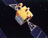 by Staff Writers
Moscow (RIA Novosti) Mar 13, 2007
The global navigation system Glonass should be cheaper and of better quality than the GPS system, Russian President Vladimir Putin said Monday. "You know what attention I pay to Glonass, and I hope relevant attention will be paid to it," Putin told Cabinet members.
Glonass is a Russian version of the U.S. Global Positioning System (GPS), which is designed for both military and civilian use, and allows users to identify their positions in real time. The system can also be used in geological prospecting.
In December 2005, President Vladimir Putin ordered the system to be ready by 2008, and First Deputy Prime Minister Sergei Ivanov said Glonass would be available to domestic users for military as well civilian purposes by the end of 2007.
The head of Russia's Federal Space Agency, Anatoly Perminov, said earlier that Russia is also in talks with the United States and the European Space Agency to prepare agreements on the use of Glonass jointly with the GPS and Galileo satellite navigation systems.
The agency plans to have 18 satellites in orbit by late 2007 or early 2008, and a full orbital group of 24 satellites by the end of 2009, he said.
[img]Ivanov said late last year that Russia will lift all precision restrictions on Glonass beginning in 2007, which will enable accurate and unlimited commercial use of the military-controlled global positioning system.
Current restrictions limit the accuracy for civilian users of Glonass to 30 meters.
The first launch under the Glonass program took place October 12, 1982, but the system was only formally launched September 24, 1993.
Andrei Kozlov, the head of the Reshetnev Research and Production Center in the Siberian city of Krasnoyarsk, Russia's leading spacecraft manufacturer, said earlier the Glonass system currently has 13 satellites in orbit.
The satellites currently in use are of two modifications - Glonass and its updated version Glonass-M. Glonass-M has a longer service life of seven years and is equipped with updated antenna feeder systems and an additional navigation frequency for civilian users.
A future modification, Glonass-K, is an entirely new model based on a non-pressurized platform, standardized to the specifications of the previous models' platform, Express-1000.
Glonass-Ks' estimated service life has been increased to 10-12 years, and a third "civilian" L-range frequency has been added.
Tests on Glonass-K satellites are scheduled for 2007.
Source: http://www.gpsdaily.com/reports/Glonass_Cheaper_To_Build_Than_GPS_Says_Putin_999.html
Europe’s GPS Loses Signal
EU satellite navigation crisis deepens as deadline nears.
May 9, 2007
By Peter Purton
The European Union is scrambling to find a way to save its planned satellite navigation system, dubbed Galileo, as it becomes clear that members of the consortium managing the project are failing to reach agreement in the eleventh hour of an approaching deadline.
On Monday, consortium members appeared far from an agreement, saying they would rather stay away from the project than be faced with financial risks without guarantees of returns. It now looks inevitable that the consortium will lose the European Union’s backing, coming as a May 10 deadline nears to set a framework and appoint a leader.
The development is significant because Galileo is Europe’s answer to the United States’ Global Positioning System (GPS) and Russia’s Global Navigation Satellite System (GLONASS), both military funded and controlled.
A deadline had been set for Aena, Alcatel-Lucent, Deutsche Telekom, EADS, Finmeccanica, Hispasat, Inmarsat, and Thales to seek agreement on a legal structure and a chief executive (see Europe’s GPS System at Risk).
Now it appears as if few alternatives remain except to scrap the project or inject significant new public funds into it. Neither option is likely to appeal to European leaders as the first would mean a major image fiasco and the second a very unpopular use of tax money.
“Our view is that the current scenario to put Galileo into place cannot work,” said Michael Cercone, spokesman for European Commission transport commissioner Jacques Barrot. The Commission is due to present alternative plans to European transport ministers May 16. As well as pumping more money into it or dumping it altogether, another option would be to take over the project directly.
Initially the European initiative was opposed by the U.S. government, but opposition has since been relaxed. If Galileo goes ahead it will be the first non-government satellite positioning system and will be compatible with both GPS and GLONASS.
Galileo has been in planning since 1999 and it had been hoped that it would be in operation by 2008. Even if it does somehow go ahead it now looks as if a fully operational commercial service may not be available before 2014. And the initial hope that the public would pay only a third of the anticipated costs of 3.6 billion euros ($4.9 billion) looks lost.
Source: http://www.redherring.com/Article.aspx?a=22230&hed=Europe%E2%80%99s+GPS+Loses+Signal§or=Industries&subsector=Communications
May 9, 2007
By Peter Purton
The European Union is scrambling to find a way to save its planned satellite navigation system, dubbed Galileo, as it becomes clear that members of the consortium managing the project are failing to reach agreement in the eleventh hour of an approaching deadline.
On Monday, consortium members appeared far from an agreement, saying they would rather stay away from the project than be faced with financial risks without guarantees of returns. It now looks inevitable that the consortium will lose the European Union’s backing, coming as a May 10 deadline nears to set a framework and appoint a leader.
The development is significant because Galileo is Europe’s answer to the United States’ Global Positioning System (GPS) and Russia’s Global Navigation Satellite System (GLONASS), both military funded and controlled.
A deadline had been set for Aena, Alcatel-Lucent, Deutsche Telekom, EADS, Finmeccanica, Hispasat, Inmarsat, and Thales to seek agreement on a legal structure and a chief executive (see Europe’s GPS System at Risk).
Now it appears as if few alternatives remain except to scrap the project or inject significant new public funds into it. Neither option is likely to appeal to European leaders as the first would mean a major image fiasco and the second a very unpopular use of tax money.
“Our view is that the current scenario to put Galileo into place cannot work,” said Michael Cercone, spokesman for European Commission transport commissioner Jacques Barrot. The Commission is due to present alternative plans to European transport ministers May 16. As well as pumping more money into it or dumping it altogether, another option would be to take over the project directly.
Initially the European initiative was opposed by the U.S. government, but opposition has since been relaxed. If Galileo goes ahead it will be the first non-government satellite positioning system and will be compatible with both GPS and GLONASS.
Galileo has been in planning since 1999 and it had been hoped that it would be in operation by 2008. Even if it does somehow go ahead it now looks as if a fully operational commercial service may not be available before 2014. And the initial hope that the public would pay only a third of the anticipated costs of 3.6 billion euros ($4.9 billion) looks lost.
Source: http://www.redherring.com/Article.aspx?a=22230&hed=Europe%E2%80%99s+GPS+Loses+Signal§or=Industries&subsector=Communications
European GPS rival transmits first navigation data
Bangalore (India) - Galileo, a European project that aims to create a civilian global navigation infrastructure, has reached a major milestone as the European Space Agency (ESA) today reported that the Giove-A satellite has transmitted the first navigation message.
Giove-A is the first of 30 satellites that the ESA and the European Commission plan to deploy at an altitude of 23,222 km to build “Galileo”, a global navigation system that is compatible with the American GPS and the Russian GLONASS. However, while Galileo will be compatible with these two older systems, it does not have a military background and is intended to secure Europe’s independence from GPS and GLONASS.
According to the ESA, a first navigation message including a navigation signal and a navigation message was uplinked to Giove-A on May 2 from the Guildford ground station. The organization explained that the message was similar to those that will be sent by the operational Galileo system and contained the information needed to measure the distance from the satellite to the user receiver

Illustration of the Giove-A satellite
Giove-A has been transmitting general signals since January 12 of last year, ESA said.
According to the organization, Galileo will be able to provide navigation data with an accuracy of about 1 meter or about 3 ft. When fully installed, Galileo will consist of 30 satellite, organized at an inclination of the orbital planes of 56 degrees. 27 of the satellites will be operational and three will act as active spares. ESA expects that the navigation system will provide coverage up to the North Cape.
Galileo is expected to be fully deployed by 2012, with operation beginning in 2008. Compared to today’s GPS, Galileo will also have a commercial component, allowing technology firms to create fee-based, “value-added” services for the system.
Source: http://www.tgdaily.com/content/view/31911/113/
Giove-A is the first of 30 satellites that the ESA and the European Commission plan to deploy at an altitude of 23,222 km to build “Galileo”, a global navigation system that is compatible with the American GPS and the Russian GLONASS. However, while Galileo will be compatible with these two older systems, it does not have a military background and is intended to secure Europe’s independence from GPS and GLONASS.
According to the ESA, a first navigation message including a navigation signal and a navigation message was uplinked to Giove-A on May 2 from the Guildford ground station. The organization explained that the message was similar to those that will be sent by the operational Galileo system and contained the information needed to measure the distance from the satellite to the user receiver

Illustration of the Giove-A satellite
Giove-A has been transmitting general signals since January 12 of last year, ESA said.
According to the organization, Galileo will be able to provide navigation data with an accuracy of about 1 meter or about 3 ft. When fully installed, Galileo will consist of 30 satellite, organized at an inclination of the orbital planes of 56 degrees. 27 of the satellites will be operational and three will act as active spares. ESA expects that the navigation system will provide coverage up to the North Cape.
Galileo is expected to be fully deployed by 2012, with operation beginning in 2008. Compared to today’s GPS, Galileo will also have a commercial component, allowing technology firms to create fee-based, “value-added” services for the system.
Source: http://www.tgdaily.com/content/view/31911/113/
Friday, April 20, 2007
Switzerland Upgrades its Nationwide Positioning Network with Trimble GNSS Infrastructure Technology
 SUNNYVALE, Calif., April 17, 2007 -- Trimble (NASDAQ:TRMB) announced today it has supplied 31 Trimble NetR5™ GNSS reference stations and Trimble Zephyr Geodetic™ 2 antennas to Switzerlands Federal Office for Topography (swisstopo) to upgrade its nationwide positioning network with Global Satellite Navigation System (GNSS) capabilities. The permanent geospatial infrastructure will support satellite signals from GPS and GLONASS, significantly optimizing real-time kinematic (RTK) positioning performance for surveying, engineering and Geographic Information System (GIS) professionals.
Known as AGNES (Automated GPS Network for Switzerland), the Swiss infrastructure enables swisstopo to provide the Swiss Positioning Service (swipos), which supplies RTK GPS and Differential Global Positioning System (DGPS) corrections to users of the network. By implementing Trimble NetR5 GNSS reference stations, which support the modernized GPS L2C and L5 signals as well as GLONASS L1/L2 signals, the network will be upgraded and called AGNES II. In addition, the selection of the new Trimble Zephyr Geodetic 2 antennas provides AGNES II compatibility with future planned constellations and frequencies.
Originally built in 1999 with Trimble GPS receivers, the network covers the entire 41,000 square kilometers (25, 476 square miles) of Switzerland, which is known for its extreme topography ranging from mountains over 4,000 meters (13,123 feet) high to its lowest lake at 193 meters (633 feet). Users of AGNES II will be able to optimize positioning performance particularly in reception-critical areas, such as areas with interrupted reception and zones with extreme topographic features.
In addition, the use of Trimble RTKNet™ software provides AGNES II with Trimble VRS™ (Virtual Reference Station) functionality, which computes a virtual reference station for the user in the field, increasing system reliability and allowing significantly greater distances between reference stations. The VRS network will provide a highly reliable, cost-effective means for surveyors and other professionals to work faster and achieve more accurate GNSS results.
The AGNES II network is designed to cover the needs of swisstopo into the future and will enable accurate and reliable centimeter-level surveying measurements to be taken faster and more cost-effectively throughout Switzerland. AGNES II is expected to be fully operational by summer of 2007.
The nationwide Swiss VRS network follows more than 80 Trimble infrastructure installations networks throughout the world including: Australia, Austria, Belgium, Canada, Czech Republic, China, Denmark, Finland, France, Germany, Greece, Italy, Japan, Kingdom of Saudi Arabia, Lithuania, Malaysia, Netherlands, New Caledonia, Norway, Poland, Portugal, Republic of South Africa, Serbia, Singapore, Slovenia, Slovakia, South Korea, Spain, Sweden, Switzerland, Taiwan, United Kingdom and U.S. For a partial reference list of Trimble VRS installations visit: http://www.trimble.com/vrsinstallations.shtml.
About swisstopo
Established in 1893, Switzerland's Federal Office of Topography (swisstopo) is responsible for all geographical reference data and products. Swisstopo creates and maintains the geodetic, topographic and geological data for Switzerland including publishing the national map series at a variety of scales and keeping them current. Swisstopo's Federal Directorate of Cadastral Surveying division oversees the official cadastral survey, providing the measurement and mapping for the national land register. Swisstopo forms part of the armasuisse group within the Federal Department of Defense, Civil Protection and Sport (DDPS). For more information, visit: http://www.swisstopo.ch/en
About Trimble VRS Technology
Trimble VRS technology uses the RTK solutions from Trimble RTKNet software and provides high-accuracy, RTK GNSS positioning for wider areas. The VRS network is available at any time without the need for field base stations and provides common control anywhere in the network.
Because Trimble RTKNet software is able to process the entire network simultaneously, Trimble VRS networks offer greater quality control and higher data accuracy at longer distances. In the field, the farther users get from a reference station using conventional RTK, the more susceptible they become to reduced accuracy and performance due to systematic errors such as ionospheric and tropospheric effects. In a Trimble VRS network, RTKNet software provides a fully modeled solution that factor in potential systematic errors. Users connect into the system using a wireless connection; the software acknowledges the users field positions and allows them to operate as though there is a reference station—a virtual reference station—right next to their rover. As a result, the PPM error is eliminated or significantly reduced, allowing surveyors to achieve RTK precision over much greater distances with fewer reference stations. Users can also retrieve stored GNSS and modeled data from the control center via the Internet for post-processing.
About Trimble's Engineering and Construction Business
Trimble, a world leader in GPS, construction lasers, robotic total stations and machine control solutions, is creating a broad range of innovative solutions that change the way construction work is done. The Engineering and Construction business of Trimble is focusing on the development of technology and solutions in the core areas of surveying, construction and infrastructure. From concept to completion, Trimble's integrated systems streamline jobs and improve productivity.
About Trimble
Trimble applies technology to make field and mobile workers in businesses and government significantly more productive. Solutions are focused on applications requiring position or location—including surveying, construction, agriculture, fleet and asset management, public safety and mapping. In addition to utilizing positioning technologies, such as GPS, lasers and optics, Trimble solutions may include software content specific to the needs of the user. Wireless technologies are utilized to deliver the solution to the user and to ensure a tight coupling of the field and the back office. Founded in 1978 and headquartered in Sunnyvale, Calif., Trimble has a worldwide presence with more than 3,400 employees in over 18 countries.
For more information Trimbles Web site at www.trimble.com.
Certain statements made in this press release are forward looking statements within the meaning of Section 27A of the Securities Act of 1933 and Section 21E of the Securities Exchange Act of 1934, and are made pursuant to the safe harbor provisions of the Securities Litigation Reform Act of 1995. These statements involve risks and uncertainties, and actual events and results may differ materially from those described in this press release. Factors that could cause or contribute to such differences include, but are not limited to: the reception, cost-effectiveness and performance of the AGNES II network; the future compatibility of the network with changing technologies and ability of the network to meet the future needs of swisstopo and its professional end-users; the operational launch date of the network; and the impact of competing networks and technologies. More information about potential factors which could affect Trimbles business and financial results is set forth in reports filed with the SEC, including Trimble's quarterly reports on Form 10-Q and its annual report on Form 10-K. All forward looking statements are based on information available to Trimble as of the date hereof, and Trimble assumes no obligation to update such statements.
Investor Relations Contact: Willa McManmon of Trimble: 408-481-7838
Media Contact: LeaAnn McNabb of Trimble: 408-481-7808
Source: http://www.trimble.com/news/release.aspx?id=041707a
Monday, April 16, 2007
Chinese rocket puts up navigational spacecraft
China launched its second satellite in less than three days Friday when a Long March 3A rocket successfully delivered a navigation craft into orbit.
Liftoff of China's fifth navigation satellite was at 2011 GMT Friday (4:11 p.m. EDT) from the Xichang launch center in southwest China's Sichuan province, according to the official Xinhua news agency.
The unannounced launch was in the early morning hours of Saturday, local time.
 The three-stage Long March 3A rocket left its payload in an egg-shaped transfer orbit with an inclination of 55 degrees. The spacecraft will soon use its propulsion system to circularize the orbit at an altitude of about 13,000 miles.
Chinese media reports said the satellite is part of the nation's Compass space-based navigation system, which aims to provide precise location, velocity and timing information to users.
State media did not name the satellite launched Friday, but earlier members of the Compass constellation were called Beidou, which means Big Dipper when translated in English.
The system is similar to the U.S. Global Positioning System and other navigation satellite fleets in development by Russia and the European Union.
The Compass system will consist of five satellites orbiting in the geostationary belt some 22,000 miles above Earth, and 30 more craft circling the planet in a medium orbit, according to earlier Xinhua reports.
Previous Beidou satellites were placed in geostationary orbit, but Friday's launch delivered the first Compass satellite to medium Earth orbit.
More satellites will join the Compass fleet in the next few years, and officials expect the system will provide navigation data to China and neighboring countries by next year. Subsequent launches will then expand the system's coverage globally, Xinhua said.
Friday's launch was the third of the year for China. The newest Beidou satellite was put in space in February, and a marine surveying spacecraft was orbited Wednesday.
BY STEPHEN CLARK
SPACEFLIGHT NOW
Posted: April 14, 2007
Liftoff of China's fifth navigation satellite was at 2011 GMT Friday (4:11 p.m. EDT) from the Xichang launch center in southwest China's Sichuan province, according to the official Xinhua news agency.
The unannounced launch was in the early morning hours of Saturday, local time.
 The three-stage Long March 3A rocket left its payload in an egg-shaped transfer orbit with an inclination of 55 degrees. The spacecraft will soon use its propulsion system to circularize the orbit at an altitude of about 13,000 miles.
Chinese media reports said the satellite is part of the nation's Compass space-based navigation system, which aims to provide precise location, velocity and timing information to users.
State media did not name the satellite launched Friday, but earlier members of the Compass constellation were called Beidou, which means Big Dipper when translated in English.
The system is similar to the U.S. Global Positioning System and other navigation satellite fleets in development by Russia and the European Union.
The Compass system will consist of five satellites orbiting in the geostationary belt some 22,000 miles above Earth, and 30 more craft circling the planet in a medium orbit, according to earlier Xinhua reports.
Previous Beidou satellites were placed in geostationary orbit, but Friday's launch delivered the first Compass satellite to medium Earth orbit.
More satellites will join the Compass fleet in the next few years, and officials expect the system will provide navigation data to China and neighboring countries by next year. Subsequent launches will then expand the system's coverage globally, Xinhua said.
Friday's launch was the third of the year for China. The newest Beidou satellite was put in space in February, and a marine surveying spacecraft was orbited Wednesday.
BY STEPHEN CLARK
SPACEFLIGHT NOW
Posted: April 14, 2007
Subscribe to:
Posts (Atom)